

Cnoicin an tSeabhaic [Clear Island]
Good walks are even better shared.
Overview
Cnoicin an tSeabhaic [Clear Island]
Cnoicin an tSeabhaic, nicknamed Clear Island, is a charming gem situated off the southern coast of Ireland. Standing at an elevation of 80 meters, this Marilyn offers a delightful trek for those seeking both adventure and tranquillity in nature.
Geology
The island boasts predominantly sedimentary rocks, particularly Devonian sandstone. This unique geology adds a layer of interest to any hike, as you navigate through fascinating rock formations and enjoy the interplay of earth and sea.
Routes
One of the most popular routes is the St. Brendan's Trail. Starting from the main harbour, this trail spans approximately 5 km and typically takes around 2 hours to complete. It is a gentle jaunt leading you along the coast, where the views of the Atlantic are simply unforgettable.
Summit Features
At the summit, hikers will be greeted by a small rocky parapet adorned with a cairn, lovingly constructed by those who have tread before you. It’s a perfect spot to take a moment and enjoy the vista.
Terrain Type
The terrain can be described as a pleasant mix of grassy patches interspersed with rocky sections. It’s generally easy on the feet, but do keep an eye out for those sneaky slippery rocks post-rain!
Views
From the peak, you are treated to spectacular panoramas overlooking the Atlantic, with the rugged coastline of Ireland unfurling before you. Notably, one can spot the Beara Peninsula in the distance, making it a photographer's paradise. For the best views, aim for spring or early summer; however, autumn's splendid hues will certainly not disappoint.
Hazards
While the trek is enjoyable, do watch your step on the rocks—especially after a rain shower. It's recommended not to engage in any impromptu rock ballet!
Nearby Summits
For the ambitious hiker, Keenagh Mountain is a nearby summit that can be combined with your Clear Island adventure, providing an additional challenge and more breathtaking vistas.
Access
Accessing Clear Island is a breeze. Parking is available at the principal pier in the village, with a nominal fee in the busier summer months. Public transport options are readily available, with a local bus service from Cork City to the ferry terminal in Baltimore.
Facilities
The village on the island has all you need—a quaint café and local shops for essentials. There are also restrooms by the ferry terminal, ensuring you can enjoy your hike without worry.
History
Cnoicin an tSeabhaic holds significance not just in its view but in its history. The name translates to 'The Hill of the Hawk,' a nod to the wildlife that thrives here. Additionally, its connection to St. Brendan the Navigator enriches the cultural tapestry of this charming isle.
In conclusion, Cnoicin an tSeabhaic offers a slice of heaven for hikers eager to explore Ireland’s natural beauty while also relishing a touch of its deep-rooted history. So pack your gear, grab your friends, and set forth on an adventure you'll cherish!
Happy hiking!
Explore routes near Cnoicin an tSeabhaic [Clear Island]
Public walks starting within 80 km of this hill. Nearby does not mean a route reaches the summit; check its map and access before setting out.
No public routes are currently listed within 80 km of Cnoicin an tSeabhaic [Clear Island] on Walkmates. This does not mean there are no paths here. Explore the map and check local access information before planning a walk.
Route planning notes
These notes describe possible approaches, not verified navigable routes or permission to cross land. Check current paths, local access rules and conditions before setting out.
St. Brendan's Trail
A scenic route starting from the main harbour, leading along the coastal trails with picturesque views of the Atlantic.
Make a day of it, together
Find someone to share the walk with, or organise a day out along a route you like.
Photo Gallery
View all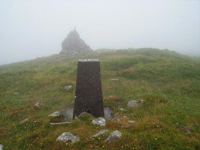 Photo could not load
V9722 : Cléire/Clear The highest point
Richard Webb
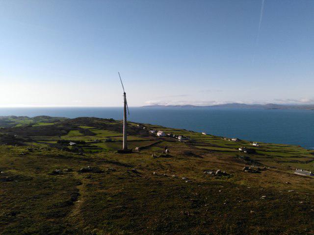 Photo could not load
V9722 : Highest Point on Cape Clear Island
Barry Hunter
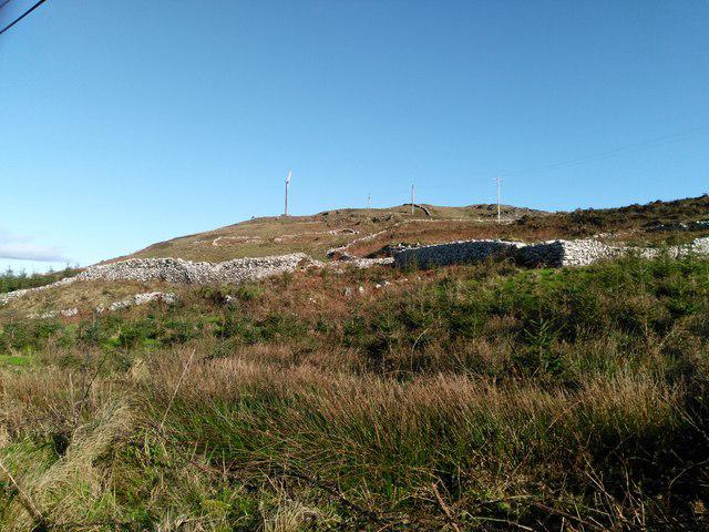 Photo could not load
V9722 : Looking towards highest point
Barry Hunter
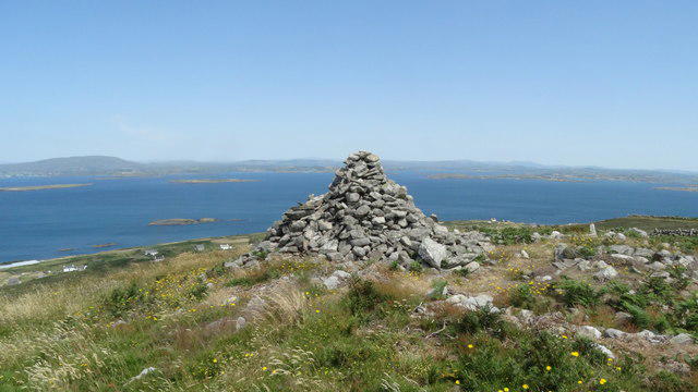 Photo could not load
V9722 : Cape Clear Island - cairn at highest point of island
Colin Park
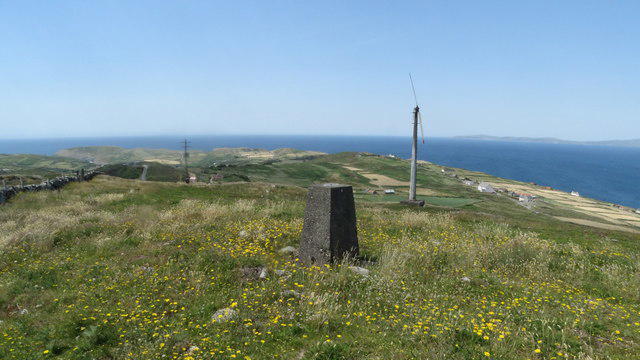 Photo could not load
V9722 : Cape Clear Island - trig point at highest point of island
Colin Park
Hill facts and local notes
Classifications
Elevation
160m
525 ft
Prominence
160m
Coordinates
51.4420, -9.4792
V972220
OS Map
88
At the Summit
A small rocky outcrop with a charming cairn built by previous visitors to honour the summit.
Terrain & Geology
The island is composed mainly of sedimentary rocks, with Devonian sandstone being prevalent. This provides a fascinating mix of geological features, making it a great spot for rock enthusiasts.
Views & Scenery
Breathtaking views of the Atlantic Ocean, the rugged coast of Ireland, and the distant peaks of the Beara Peninsula.
History & Heritage
Name Origin
Cnoicin an tSeabhaic translates to 'The Hill of the Hawk,' reflecting the island's wildlife and natural essence.
Historical Significance
Clear Island has a rich maritime history, renowned for its connection to St. Brendan the Navigator, who is said to have journeyed across the Atlantic.
Getting There & Facilities
Check current local access restrictions, parking rules and transport timetables before travelling. These notes do not confirm public access to the summit.
Parking
Parking is available at the main pier in the village, with a small fee during peak tourist season.
Public Transport
Local bus services run from Cork City to the ferry terminal at Baltimore, from where ferries operate to Clear Island.
Nearby Facilities
The village features a small café serving local dishes and some shops with essential supplies. Toilets are located near the ferry terminal.
Safety Information
Known Hazards
- Occasional slippery rocks, particularly after rain; keep a steady foot and avoid the urge to dance on the rocks!
General Safety Tips
- Check weather conditions before setting out
- Carry appropriate clothing and equipment
- Let someone know your planned route
- Take a map, compass, and GPS device
- Carry emergency supplies: food, water, first aid kit, torch
Hills
Some common questions about the hills answered
Are there group walks up Cnoicin an tSeabhaic [Clear Island]?
Many walkers use Walkmates to join or organise walks with others. You can check for group walks around Cnoicin an tSeabhaic [Clear Island] through the maps
Are there other walkers around Cnoicin an tSeabhaic [Clear Island]?
Activity varies by location and time, but Walkmates lets you see whether others have shared walks or shown interest in this area. Find other people through the walking friends search walking friends for Cnoicin an tSeabhaic [Clear Island] search or of course create your own walk for Cnoicin an tSeabhaic [Clear Island]
Can I organise a walk to Cnoicin an tSeabhaic [Clear Island]?
Yes. If there aren’t any walks listed already, you can create a walk and make it available for others to join.
If you're signed up to Walkmates, you can create a walk to Cnoicin an tSeabhaic [Clear Island].
How do I find a walk up this hill?
There are often multiple ways to walk this hill, depending on experience and route preference. Walkmates helps you explore walks and routes that others have shared.
Can I suggest a new route up Cnoicin an tSeabhaic [Clear Island]?
Yes. You can suggest or create routes to share with others. Walkmates focuses on the social side of walking, so routes are used to help people organise walks and explore areas together, rather than as detailed navigation tools or route libraries.
Other uses really appreciate knowledgeable walkers sharing their routes. Share your favourite route to Cnoicin an tSeabhaic [Clear Island] here
The is an error or something incorrect about this hill. How do I let you know?
We always strive to keep the information on Walkmates as accurate as possible. If you find an error, please let us know through the contact form and we'll aim to correct it as quickly as possible
Community Discussion
Comments
Location
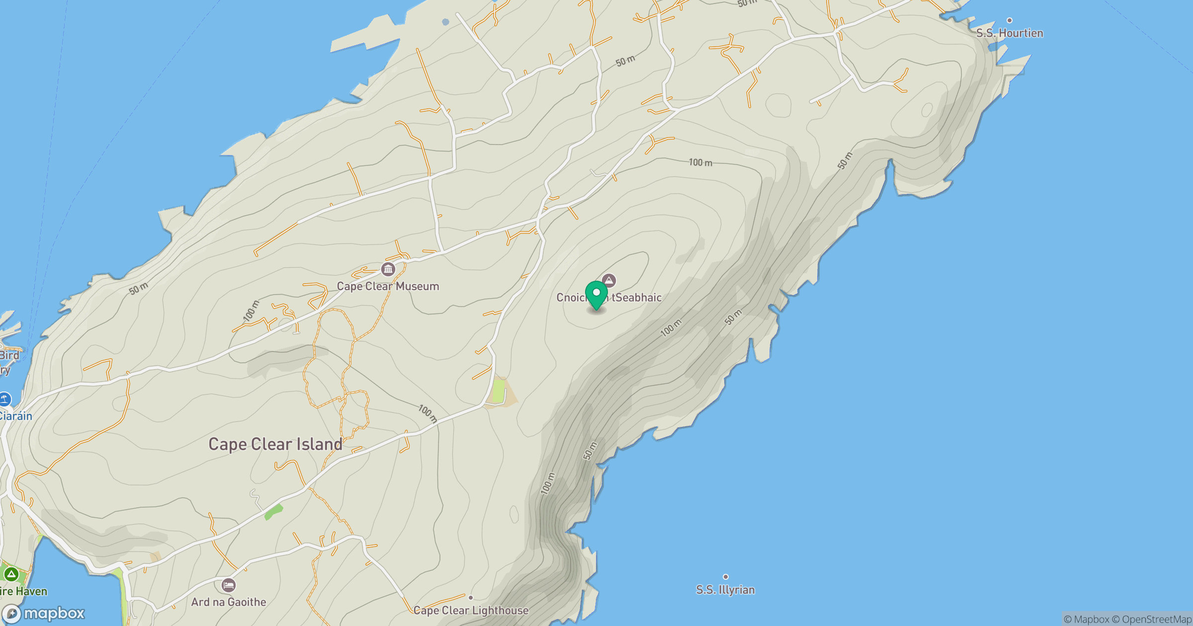
Grid reference: V972220
View on OpenStreetMapOpens a map in a new tab, centred on the hill.
Hills within 30 km
Straight-line distance, not a walking route or confirmation of access.
Slievemore (Sherkin Island)
101m
Mount Gabriel [Cnoc Osta]
407m
Mount Corrin
284m
Knockaughna
268m
Knockomagh
197m
No comments yet. Be the first.